GIS for municipalities
The geographic information system (GIS) is presently an essential tool for rational decision making and planning of the development of municipalities.
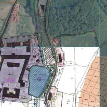
The geographic information system is used both in the private sector and in local government and public administration, in areas such as land use decision making, management of utility lines or analyses of different data sets. Its main contribution is the combination of the graphical part of data with the database part of data. Graphical data in the system may be in the raster form (aerial photographs, historical maps,…) or in the vector form (digital maps, CAD drawings, …) and also as a web mapping service WMS/WFS.
Our office will help you both in the GIS implementation as a whole and in the creation of data for individual components of the information system.

